Now we've got a
"statement":
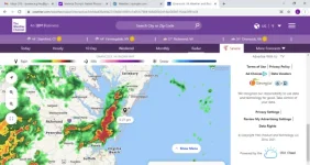
Special Weather Statement until THU 7:30 PM EDT
1 of 6
Action Recommended
Avoid the subject event as per the instructions
Issued By
Wakefield - VA, US, National Weather Service
Affected Area
Accomack County
Description
...A LINE OF STRONG THUNDERSTORMS WILL AFFECT EASTERN SOMERSET... SOUTHEASTERN WICOMICO...WORCESTER...ACCOMACK AND NORTHERN NORTHAMPTON COUNTIES... At 652 PM EDT, radar indicated strong thunderstorms were located along a line extending from Princess Anne to 7 miles northwest of Cheriton. Movement was east at 30 mph. Wind gusts in excess of 40 mph are possible with these storms. Locations impacted include... Ocean City, Pocomoke City, Princess Anne, Exmore, University Of Maryland Eastern Shore, Berlin, Snow Hill,
Onancock, Parksley, Onley, Nassawadox, Westover, Willis Wharf, Marion Station, Newark, Cape Isle Of Wight, West Pocomoke, Ocean Pines, Accomac and Melfa. Strong wind gusts are possible with these storms. These wind gusts are capable of knocking down tree limbs, small or weakened trees, and blowing around trash cans, potted plants, lawn furniture, and other light outdoor objects. Motorists should use extra caution in the vicinity of these storms. Be prepared for rapid changes in weather and road conditions. Heavy rain could cause ponding of water on roads, and possible minor flooding of ditches and poor drainage areas.

") ,,,,,,,,,,,,,,,,,
,,,,,,,,,,,,,,,,, ,,,,,,,,,,,,,,,,,,,